Plans for development in Ormiston that would impact on motorists commuting to and from Cleveland via Finucane Road are proposed to be fast tracked through the State Government’s Ministerial Infrastructure Designation process instead of the normal town planning process administered by Redland City Council.
We wrote about this project in our story:
Finucane Road development plans include new traffic light intersection
Ministerial Infrastructure Designation objections
The community has until 4th September 2023 to comment about this application for use of the Ministerial Infrastructure Designation process.
Anyone can make a submissions to the Government using an online form here.
For assistance or further information about the infrastructure designation process, email infrastructuredesignation@dsdilgp.qld.gov.au or call 1300 967 433.
Shown below is a template submission which sets out reasons why the request for Ministerial Infrastructure Designation should be refused.
Application for Ministerial Infrastructure Designation MID-0523-0700 – Hub68 Centre for Excellence
The application for Ministerial Infrastructure Designation MID 0523-0700 Hub68 Centre for Excellence should not be approved.
This private sector proposal should be the subject of a development application made to Redland City Council in accordance with the Planning Act 2016.
MIDs can be used for private sector development but this should be for projects that are highly important for the State.
The purpose of MIDs is to facilitate development of infrastructure of State significance.
This MID application is for uses that primarily serve the local community. Proposed developments that are of a local nature should be assessed by local government against the provisions of the local planning scheme which in this case is the Redland City Plan.
If this application for Ministerial Infrastructure Designation (MID) is approved, it will subvert normal local government planning process intended under the Planning Act.
Strategic Planning Considerations
The site is outside of the Cleveland Activity Centre within which most of the proposed uses should desirably be located. Although it is located on an arterial road, it is not well serviced by public transport, such as is available within the Cleveland Town Centre.
Good planning practice would locate uses such as the hospital, other medical facilities and special retail within the Cleveland Centre.
Alternatively, they could be co-located with the medical precinct at Weippin Street, whereby the benefits of scale might outweigh the disadvantages associated with the remoteness of that precinct.
If the Redland City Plan has not adequately provided for the communities needs for medical and aged care facilities then this should be dealt with through a properly considered review of this planning scheme involving community consultation.
The State Government noted that it and Redland City Council have concerns with the proposed development occurring ‘out-of-centre’, in pre-lodgement advice to the project proponents.
Pre-lodgement advice from Redland City Council noted that the proposal was inconsistent with the Redland City Plan.
Traffic Considerations
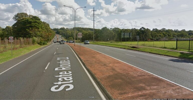
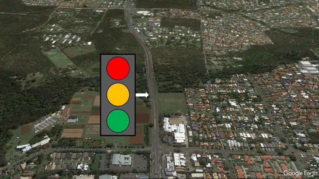
The magnitude and nature of the proposed development cannot be adequately serviced by a single vehicular access at Delancey Street. A second vehicular access from Finucane Road is therefore proposed. That private access is on the main arterial road into Cleveland. This road is a Limited Access Road for good reasons. It is a movement corridor not an access road.
Access to a single development site is inappropriate for a limited access road of this nature. It is an important principle of good transport practice that dilution of this important movement corridor function should not occur.
All vehicular access to the site should be via Delancey Street which is a local access road. If the proposed development causes inappropriate traffic impacts associated with this access, then the nature and magnitude of the proposed uses of the site are inappropriate. The uses should be changed and scaled back whereby the site can be adequately serviced by the Delancey Street access only.
Detailed Traffic Considerations
The following matters of detail relate to the inadequacy of the traffic impact assessment that accompanied the application.
The traffic impact assessment report ignores the proposed Toondah Harbour Development. If it ever were to proceed, a major residential development at Toondah Harbour would generate significant increases in the traffic volumes on Shore Street West and Finucane Road. The traffic report should have contemplated this possibility.
Future upgrades to the road system will be needed because of traffic growth even if the proposed Toondah development does not occur. The base case for determining the appropriate road improvements required by the subject development should be the future road layouts that are needed without the subject development occurring. Otherwise, the proposed development is only using up the cheap upgrade options, leaving the difficult and more expensive upgrade solutions to public authorities.
Examples of the future improvements required to the road system without the subject development (which should be used as the base case for the additional improvements to be provided by the proposed development to achieve no-worsening by the generated traffic) are described below:
- Widening of the Finucane Road reserve on the southern side west of Delancey Street to accommodate needed carriageway shoulders/breakdown lanes, safe bus bays and active transport needs. This should have occurred when this section of road was constructed in 1987, but it was prevented because of DPI experimental work being undertaken on this land at the time. This carriageway is currently unsafe and the land transfer to road reserve (of the State government land) and the road improvements are overdue.
- Widening of the Finucane Road westbound carriageway to provide for the above mentioned carriageway improvements.
- Widening of the Finucane Road eastbound carriageway to provide two through stand-up lanes and two right turn stand-up lanes at the intersection together with a separate free left turn lane.
- Widening of Delancey Street south of the Finucane Road intersection to provide a separate free left turn lane, a through lane and a combined through/right turn lanes on the southern approach to the intersection, together with two lanes merging into one on the southbound carriageway.
- Widening of Delancey Street south of the Finucane Road intersection to provide a separate free left turn lane, a through lane and a combined through/right turn lanes on the southern approach to the intersection, together with two lanes merging into one on the southbound carriageway.
- Widening of Delancey Street north of the Finucane Road intersection to provide separate free left turn, a through lane and right turn lanes on the southern approach to the intersection and two lanes merging into one on the northbound carriageway. (The tree in the verge should be removed to allow for widening of the southbound carriageway between Arthur Street and Shore Street West so that the stand-up capacity can be improved.)
- Provision of safe pedestrian pathways in the verges of all routes, in particular formation widening for same on both sides of Finucane Road between Hilliards Creek and Delancey Street.
- Provision of on-carriageway and off-carriageway cycle facilities on Finucane Road, Shore Street West and Delancey Street.
The traffic impact report incorrectly stated that the posted speed limit is 70 km/h (page 6) whereas, other than through the Delancey Street intersection, the speed limit is 80 km/h. This presents a different picture of the speed environment proposed to be changed by the proposed development. If the development does proceed with the new signalized intersection, it is likely that the current speed limit of 80 km/h on both sides of Finucane Road between Delancey Street and McDonald Road will be reduced to 70 km/h. This is not considered appropriate for traffic movement and traffic safety reasons.
The traffic impact report recommends the banning of right turn traffic out of the existing Delancey Street vehicular site access (page 10). This is considered desirable, but it should also be accompanied with a central traffic island between Freeth Street and Finucane Road with a protected right turn lane for the site access, together with a roundabout at the Freeth Street/Delancey Street intersection. The design of this section of road to achieve an operationally safe outcome will not be straightforward. The documentation submitted with the application should demonstrate how this will be achieved.
In accordance with normal practice adopted by the Department of Transport and Main Roads, assessing of traffic impacts has been undertaken on a 10 year-horizon from development’s anticipated completion date (page 11 of the traffic impact assessment report). A longer timeframe should be used for strategic decisions such as amending the limited access road status and future road planning needs.
Furthermore, the traffic impact report modelled the traffic impacts in 2034. Full development of the site will not be achieved by 2024. A more realistic horizon should be used.
The traffic impact assessment report used traffic counts undertaken on 29th October 2020 (page 12). Given COVID-19, these are unlikely to be representative of normal times.
Redlands2030 – 1 September 2023
Please note: Offensive or off-topic comments will be deleted. If offended by any published comment please email thereporter@redlands2030.net