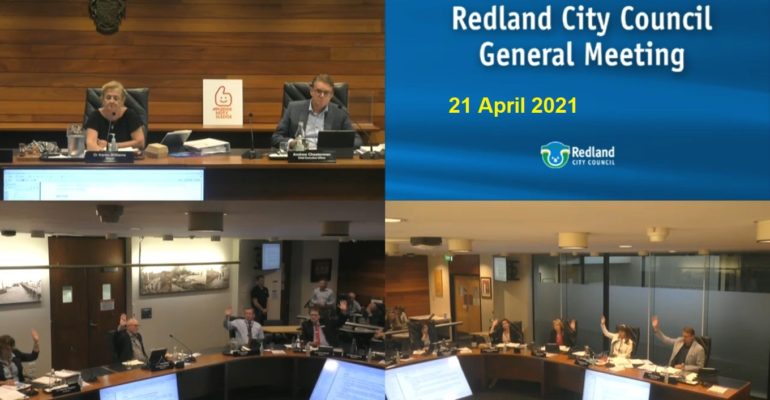
Councillors voted 8/3 to support Cr Golle’s motion about freshwater buffer areas.
Home owners and the environment could benefit from a review of city plan provisions for freshwater buffer areas, initiated by Cr Paul Golle at the council meeting on 21 April.
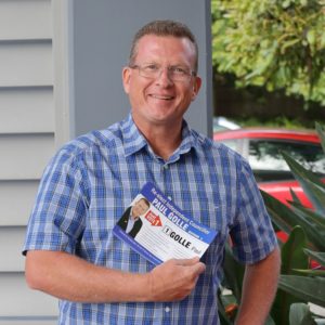
Cr Golle told Redlands2030 that he called for this review of freshwater buffer areas to protect homes and have changes made to the City Plan regarding corridors and natural freshwater bodies.
“There have been far too many homes impacted by flooding through development changing the lay of the land” he said.
“You can’t simply just insure your way out of overland flows being changed through development and the buffers between residential properties and known water ways needs to increase”.
“I have received numerous complaints about homes being inundated by flood waters, primarily because the planning system allows for homes to be built within 25 metres of known water bodies and an artificial approach of mitigation via back filling or building retaining walls only serves to increase the flows of water into people’s homes”.
“Wetlands are being filled in and relaxations are given to developers for extra lots in known flood ways and needs to stop”.
“The acceptance of my motion will set council on a path of changing the distances between homes and known low- lying land thanks to the majority of councillors supporting my motion based on common sense”.
Council’s motion to review freshwater buffer areas
Cr Golle’s motion to improve protection of freshwater buffer areas was worded as follows:
That Council resolves to request officers to undertake the following:
1. To prepare a report to Council by the end of July 2021 which:
a) Provides options and recommendations related to assessment benchmarks in the City Plan for artificial waterbodies and buffers to waterways (for the purposes of flood protection).
b) Evaluates the pros and cons of making reconfiguring a lot impact assessable where all land within the Recreation and Open Space zone is not proposed to be contained within a single lot.
2. To prepare a major amendment as part of the next general amendment package, pursuant to Part 4 of the Minister’s Guideline’s and Rules under the Planning Act 2016, if required, incorporating the proposed changes to City Plan as supported by Council
The motion for Item 17.2 Assessment benchmarks for artificial waterbodies was carried 8/3.
The meeting minutes show that Crs Wendy Boglary, Peter Mitchell, Paul Gollè, Lance Hewlett, Rowanne McKenzie, Tracey Huges, Adelia Berridge and Paul Bishop voted FOR the motion. Crs Karen Williams, Mark Edwards and Julie Talty voted AGAINST the motion.
Consideration of this item can be viewed on the Council meeting video recording commencing at time 3:27:55.
Background information provided by Cr Golle
Cr Golle’s motion to protect freshwater buffer areas included extensive background information shown below in full.
Background for 1 a)
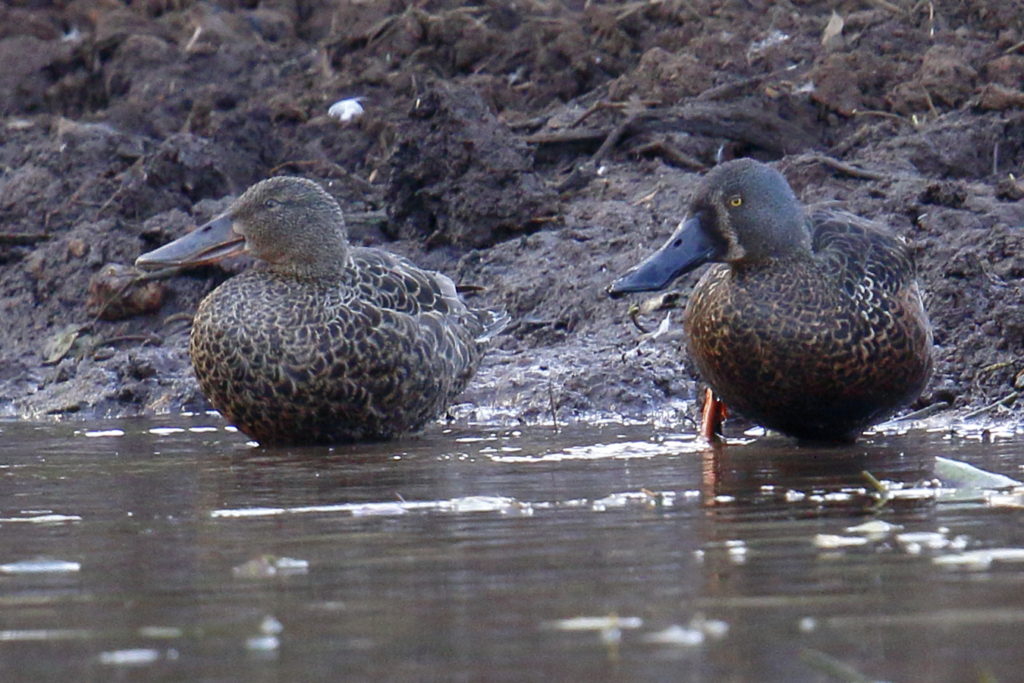
In former agricultural, now developed landscapes such as the Redlands, natural habitat is often only available in small, isolated patches or corridors consisting of dry creek lines, historic dams, wetlands, and riparian bushland.
These changing landscapes are unable to support their full complement of native plants and wildlife, and those that have survived may have trouble.
Many species of native animals are not migratory or nomadic and may have small territories requiring a mixture of bushland habitat and open grassland areas for feeding and protection, relying on man made water bodies such as historic farm dams.
Other mammals such as the flying fox look for roosting sites along creek lines and dams and often the human interaction creates long term issues.
As residential development continues through the South East Queensland Regional Plan, corridor habitats are being deemed as creek line corridors, impacting native species habitation due to buffers only being 50 metres either side of the centre line of the water body.
The long-term survival of native species depends on the movement of genes from one population to another over many generations. Where corridors are broken or freshwater bodies are impacted by back filling or the removal of established freshwater ecosystems such as historic farm dams, populations of native plants and animals (even those living in protected habitats) may become isolated and may eventually become inbred and this can lead to local or regional extinctions.
Natural re entrants in the Redlands, historically have been used to capture freshwater for livestock and irrigation through the construction of dams. However, as food production has departed, those historic freshwater dams now form large important ecological waterways complimenting wildlife corridors. Historic farm dams are often the only freshwater source available for native species as creek lines become impacted through drought and urban residential development.
Wildlife corridors consisting of creek lines and captured freshwater bodies to include re entrants shaped to catch fresh water, should be wider consisting of a buffer from centre of waterline 200 metres either side. Corridors should reflect 3 key elements, water, remnant bushland habitat and open grassed feeding areas. In general, the wider the corridor, or the larger the patch, the more resilient it will be, and the greater its habitat value, giving a wider range of species the chance of survival.
Establishing wide corridors in core areas free from edge effects will provide enough resources for native species to survive. Edge effects are described as the human interaction, which also consists of water flow from established dwellings washing into creek lines and freshwater dams, impacting water quality.
A recent ecological report provided by a developer and accepted by council in the justification of back filling natural wetlands to accommodate lots, footpaths and road networks suggested, the area was an old farm dam not connected to existing wetlands and a mosquito infested breeding ground for cane toads, justifying the action to back fill the area.
This was not factual, and the existence of many varied species of birdlife and mammals are present, with the dividing line between councils managed wetlands and the alleged farm dam, being a barbwire fence line, dividing private and council ownership.
The water body is in fact one continuous area flowing down into the bay, fed naturally by existing creek lines and overland flow forming a riparian corridor. The creek line and main water body is approximately 25 metres or less from existing urban residential structures and has areas already experiencing subsidence.
Some residents living in that area, have expressed concerns over subsidence as residential yards begin to sink. Put simply, subsidence is the downward shifting of the ground. If a structural engineer tells you your home is suffering from subsidence, what they are really telling you is that your home is sinking. Many of the homes in that area have been raised through back filling and retaining walls, creating an artificial means of levelling an area away from natural water flow areas, to create building lots. However, this has not prevented water impacts to streets and homes.
A report regarding the 2011 floods drafted by Macquarie University stated, the fundamental question that needs addressing is not the insurability of flood risk, but how best to deal with the legacy of poor land-use planning decisions that has left some homeowners in locations now designated as high risk. Development in low-lying areas, for example, has occurred despite the history of flooding and has resulted in large concentrations of properties being left exposed.
How to reduce this exposure to flooding should be the key policy objective. Flood risk management should aim to reduce a community’s flood risk to acceptable levels, either by reducing exposure to flooding by prudent land-use planning, or by reducing the vulnerability of people and property to flooding. The authors believe that nothing will change until local councils are held accountable for bad land-use planning decisions.
Insurance is not an alternative to risk management; it is a means of transferring the residual risk once risk management measures have been put in place. To actively contribute to flood risk management, insurance must act to reduce the number of homes at risk. The only mechanism available is to ensure and thereby encourage homeowners and local councils to undertake appropriate mitigation efforts and enact risk-informed land-use planning practices.
Development must either be prevented or allowed only in a flood-resilient manner. A recent study of publicly available flood risk information on local government websites identified that less than 50% of local councils provide flood risk information. Of those with a recognised flood risk, only 67% provided flood maps online.
Wetlands in Australia, more locally in the Redlands help to improve water quality supplied to downstream environments in several ways. By spreading out and slowing down flows they reduce erosion and prevent sediment being transported downstream where it might affect the ecology and productivity of other environments, in particular estuaries, seagrasses, and the bay.
When wetlands, dams and creek lines are preserved and healthy, their soils and vegetation can capture, process and store nutrients and/or contaminants, and if the natural rhythms and flows of the wetland are undisturbed, the release of potential stressors such as sediments, nutrients, acids and/or metals from the soil and urban development can be prevented. Healthy wetlands can assist in removing harmful bacteria, and wetlands can also be important in the management of urban stormwater and effluent by improving the removal of nutrients, suspended material, and pathogens from water prior to its return to the environment.
Wetlands, historic farm dams and riparian corridors in the Redlands are threatened by earthworks where developers have been allowed to back fill natural overland flow paths, drastically changing the landscape. Drainage and water extraction from urban development are all activities which now pose threats to private properties through flooding, further impacting wildlife corridors, depleting, and changing natural overland flows.
Far from being useless, disease-ridden places, wetlands, historic farm dams and natural creek lines provide values that no other ecosystem can. These include natural water quality improvement, flood protection, shoreline erosion control, wildlife habitat and opportunities for recreation and aesthetic appreciation.
More importantly these freshwater areas, consisting of overland flow, offer life to an already stressed range of native species.
Background for 1 b)
Currently in City Plan, the level of assessment for Reconfiguring a Lot (RaL) on a property containing a split zone such as the Recreation and Open Space (ROS)/ Low Density Residential (LDR) is code assessable. In line with the amendment implemented as part of Minor Amendment Package 01/2014 to the former Redland Planning Scheme 2006 (attached), this amendment seeks for the level of assessment to be increased to impact assessment where land within the ROS zone is not proposed to be contained within a single lot.
The reason for considering this amendment is two-fold. Firstly, the level of assessment would serve to discourage a private landowner from creating additional lots in the Recreation and Open Space Zoned portion of the lot. Secondly, where an applicant did propose to create lots in the Recreation and Open Space Zoned part of the lot (i.e. in areas where the community would not reasonably expect for new lots to be created), the community would be given the opportunity to make submissions that would be considered as part of the development assessment process. This amendment is not intended to apply where the RaL is being undertaken by Redland City Council.
Further reading about freshwater buffer areas
- Heartbreak from a neighbouring development RCB 24 January 2017
- Thornlands developer issued with enforcement notice RCB 2 February 2017
- Thornlands subdivision on Council agenda Redlands2030 15 November 2020
- Thornlands 52-lot estate to be developed near wetlands off Thornlands Road RCB 18 February 2021
- Redland City Council to set standards for flood protection after motion by Cr Paul Golle RCB 26 April 2021
Redlands2030 – 11 May 2021
Please note: Offensive or off-topic comments will be deleted. If offended by any published comment please email thereporter@redlands2030.net
One Comment
The Review and Proposal relating to the Freshwater buffer areas by Cr Paul Golle is very sensible and based on facts. I noted that it was passed by Redland City Council 8/3 and the 3 who voted against it are councillors who consistently vote in favour of developers without fully considering the consequences. I have spoken to vegetable farmers adjacent to the development under construction, known as Shoreline. Staff members of Lendlease have informed them that they intend to direct treated sewage into Serpentine Creek or the Logan River System, which currently has a number of prawn farms. For this reason some members of Logan City Council have expressed in writing their concerns about the effects of treated sewage on the prawn farms. The staff at Lendlease also mentioned their plan to fill in historic farm dams and natural lakes in the area near their housing lots. These dams and lakes are foraging grounds for a host of birdlife, fish and crustaceans. It is obvious that the environmental aspects of the above plans by Lendlease have not been factored into the decision process and both Redland City Council and the Labor State Government have fallen short of their duty. Also the road congestion along Redland Bay – Cleveland Road causes long delays every morning because traffic is only allowed to flow in one direction at a time through the Shoreline Development area.